Years ago, a developer named Popkin was partway through building the Sun Tide II condominiums on South Padre Island when a young attorney from the state attorney general's office showed up with bad news. The building site, he said, sat too far out on the beach. It didn't matter what the plat showed or what the county had approved. Under Texas law, the beach itself starts and stops somewhere else entirely, and that line has a habit of moving.
Decades later, the same mechanism still shapes every beachfront closing on the island. If you're buying or selling Gulf-front property here, the number that should worry you isn't the list price, the HOA fee, or even the windstorm premium. It's a legal boundary that has nothing to do with your survey, moves with the weather, and can quietly turn a legally built home into a structure sitting on public land.
The Boundary Nobody's Plat Actually Shows
Texas's Open Beaches Act, passed in 1959, guarantees the public a right of access to the state's Gulf beaches. That access runs from the mean low tide line to the natural line of vegetation, the point where sand gives way to sea grass and dune growth. Everything seaward of that vegetation line is functionally public, even when a private owner holds title to the land beneath it.
Here's the complication that has driven disputes on this island since Sun Tide II: nobody has ever agreed on a single, fixed way to locate that line. The law also references an alternate measure, roughly two hundred feet inland from mean low tide, a distance that can land closer to the water than the actual vegetation. Two legitimate ways to measure the same boundary, producing two different answers. On a barrier island where cattle grazing once stripped the dune vegetation bare and modern owners have replaced dunes with seawalls and lawns, locating the historical vegetation line at all can turn into its own dispute.
That ambiguity is not academic. It is the reason a builder can secure local approval and still get a stop-work order from the state.
What Gets Disclosed, and Why It's Required
Because the state can assert a public easement over land you otherwise own outright, Texas requires sellers to say so upfront. Section 61.025 of the Natural Resources Code mandates a statutory disclosure for anyone selling property seaward of the Gulf Intracoastal Waterway, which covers virtually every Gulf-front parcel on South Padre Island. The disclosure exists specifically to put buyers on notice that the beach easement can affect their use of the property, regardless of what the deed says about acreage or boundaries.
For a buyer relocating from out of state or purchasing sight unseen, this is the paragraph in the closing package that deserves an actual read, not a skim. It is not boilerplate. It is the state telling you, in writing, that ownership here comes with a built-in asterisk.
The City Lines That Decide What You Can Rebuild
Layered on top of the state's vegetation-line easement are two city-drawn boundaries that determine what construction is even permitted, and both are worth knowing by name before you make an offer on anything close to the beach.
The Dune Protection Line runs along the east right-of-way of Gulf Boulevard through most of the city, and along the east right-of-way of Park Road 100 within the Shores Subdivision. Any construction, filling, clearing, or substantial improvement east of that line requires a city permit, full stop, whether you're pouring a foundation or replacing a fence.
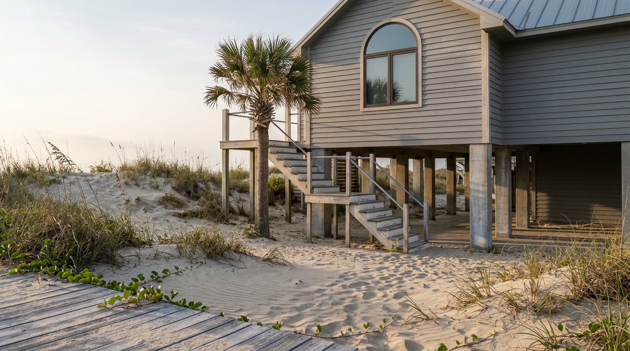
The Historic Building Line, set by the Texas Attorney General and kept on file with the city, is even stricter. East of it, the only structures the city allows are walkovers, the elevated boardwalks that get beachgoers from a property to the sand without disturbing the dune system. If a home or condo building sits east of that line, or ends up there after a storm reshapes the shoreline, rebuilding in place isn't guaranteed even if the original structure predates the rule.
For a buyer evaluating an older beachfront property, the practical question isn't just "how's the roof." It's whether the structure's footprint has ever been checked against these lines, and whether any additions were permitted east of them.
Why the Beach Got Wider This Year
Here's where the story gets more interesting for anyone transacting on the island right now. South Padre Island's beaches have historically eroded at a rate of 5 to 10 feet of coastline a year, a trend engineering firm HDR has tracked since it began advising the city on erosion control in 1994. Since then, the Army Corps of Engineers and the city have placed more than 3 million cubic yards of sand on South Padre's beaches to fight that loss.
The most recent chapter of that effort began in the second half of 2025, when the city, Cameron County, and the Army Corps partnered to dredge sand from the Brownsville Ship Channel and pump it directly onto eroded stretches of beach. According to the city's coastal coordinator at the time, the project was designed to add up to 150 feet of beach in the areas it covered, with completion originally targeted for the end of May 2026.
For a seller, a wider beach in front of the property is good news on its face. It pushes the practical shoreline, and often the vegetation line along with it, further from the structure. For a buyer, it's a reason to ask when the current beach profile was last surveyed rather than assume the listing photos reflect a stable, permanent condition. Renourishment buys distance. It doesn't rewrite the underlying law, and Texas courts have been explicit that gradual changes and sudden ones are treated differently.
That distinction traces back to a Galveston case, Severance v. Patterson, where Hurricane Rita's storm surge pushed the vegetation line landward overnight and put previously compliant rental homes on what was suddenly public beach. The Texas Supreme Court ruled that a sudden, storm-driven shift does not automatically extend the public easement onto the newly exposed land the way gradual erosion would. The state can still pursue the easement, but through eminent domain and compensation rather than an automatic taking. It's a nuance that matters here too: a hurricane can move your legal boundary overnight, and the rules for what happens next depend on whether the change was gradual or sudden.
The Texas Supreme Court is still actively working through open beaches disputes, including a ruling this past July on the state's authority to temporarily close Boca Chica Beach for SpaceX launch activity. Not directly about vegetation lines or beachfront homeowners, but a reminder that this body of law hasn't settled into something a buyer can assume stays fixed for the life of a mortgage.
What This Means If You're Buying or Selling Now
If you're selling a Gulf-front property on South Padre Island, the disclosure under Section 61.025 is not optional paperwork to rush through at closing. Pair it with documentation of any permits pulled for work near the dune line, and be ready to answer whether the structure's footprint has ever been checked against the Dune Protection Line or Historic Building Line.
If you're buying, ask for a current vegetation-line determination rather than relying on the tax plat or an old survey. Ask how the property has fared through past renourishment cycles and whether any part of it sits east of the Historic Building Line. None of this is a reason to avoid beachfront ownership here. It's a reason to make sure the person representing you actually knows which lines matter before you're staring at them in a title commitment.
Frequently Asked Questions
Does the beach renourishment project mean the vegetation line is permanently farther from my house now? Not permanently. Renourishment adds sand and buys distance, but the line still moves with future storms and ordinary erosion. Treat a wider beach as current condition, not a guarantee.
If my property ends up seaward of the line after a hurricane, do I lose it outright? Not automatically. Under the reasoning in Severance v. Patterson, a sudden storm-driven shift doesn't create an automatic public easement the way gradual erosion would. The state would need to pursue the claim through eminent domain, which involves compensation.
Who actually determines where the vegetation line sits? The Texas General Land Office has authority to make that determination, and the city coordinates with the GLO's Shoreline Task Force on related permitting. A private survey can locate current vegetation, but a formal line determination is a state matter.
Does this affect condos the same way it affects single-family beachfront homes? The state and city rules apply to the land and any structures on it, so a beachfront condominium building can be affected the same way a house can, particularly for older buildings whose original footprint predates current line locations.
If you're weighing a Gulf-front purchase or getting ready to list on South Padre Island, Gallo Realty can walk you through exactly which lines apply to a specific property, what's been permitted on it historically, and what the current disclosure should say before you sign anything. Let's Connect.